Homebuilders working in Willoughby seldom encounter the same ground conditions as those excavating near the Nicomekl River floodplain. The upland glacial till that dominates much of Walnut Grove is a world apart from the compressible silts and peats hidden beneath the low-lying pastures of south Langley. A single borehole log won't capture these transitions with enough detail when you're trying to place footings within a narrow lot. An exploratory test pit opens a window into the upper three to four metres of the soil column, letting the geotechnical engineer walk the excavation, photograph the strata, and collect representative samples right where the footing will bear. In a township where post-glacial deposition created pocketed lenses of soft clay between dense till ridges, visual logging through test pits often reveals buried organic horizons that CPT refusal traces can mask.
Seeing a peat lens exposed in a test pit wall tells you more about differential settlement risk than a dozen SPT blow counts from an adjacent borehole.
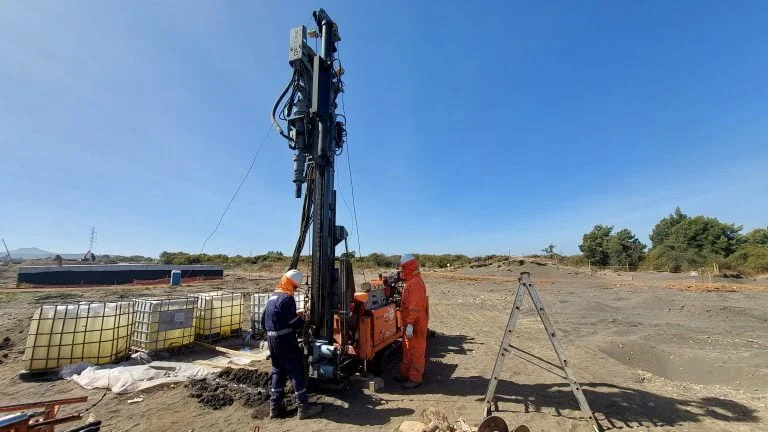
Method and coverage
Regional considerations
Around the Langley Bypass industrial corridor, we regularly identify buried construction debris within the upper two metres—old concrete pads and asphalt millings that look competent at surface but mask soft organics underneath. Skipping an exploratory test pit in these redeveloped parcels means the structural engineer designs for a uniform bearing stratum that simply doesn't exist. The bigger concern in the Township's southern agricultural belt is differential settlement: a strip footing bridging from dense till onto a thin peat-filled swale can rotate within the first wet season. A single test pit opened straddling the suspected transition zone lets us measure the actual dip of the contact and prescribe either over-excavation or a grade beam with controlled stiffness. Without that visual confirmation, the risk transfers entirely to the foundation contractor, who has no contractual mechanism to manage it.
Process video
Standards that apply
ASTM D2488-17e1 (Visual-Manual Classification for Geotechnical Logging), NBCC 2020 Division B Section 4.2 (Foundation Design), CSA A23.3:19 (Design of Concrete Structures, relevant for nearby footings)
Complementary services
Fill & Debris Delineation
Excavation through reworked ground in older Langley City lots to map the base of anthropogenic fill, identify buried organics, and log the underlying native stratum for shallow foundation design.
Stratigraphic Window Sampling
Collection of bag samples and block specimens from targeted horizons within glacial till and glaciomarine clay for laboratory strength and consolidation testing, supported by field vane shear measurements at the pit floor.
Groundwater Interface Mapping
Observation of perched water tables within sandier till members and measurement of stabilized seepage levels after 24 hours, critical for basement waterproofing design in the Brookswood area.
Typical parameters
Top questions
How much does an exploratory test pit cost in Langley?
For a standard exploratory test pit excavated to 3.5–4.0 metres in accessible ground, including visual logging, field testing, sample collection, and a summary report, budget between CA$730 and CA$980. Sites requiring traffic control on major arteries like 200 Street or 208 Street may incur additional mobilization charges.
Does WorkSafeBC require shoring for a 4-metre-deep test pit?
WorkSafeBC regulations classify any excavation deeper than 1.2 metres as a confined space requiring hazard assessment. For pits exceeding 3 metres, our protocol includes benched or sloped walls, gas monitoring before entry, and a standby person at surface level. Shoring is typically needed only where slopes steeper than 1:1 cannot be maintained due to adjacent structures.
Can a test pit replace a borehole for a single-family home foundation?
In many Langley subdivisions built on competent glacial till, an exploratory test pit logged to 4 metres provides adequate bearing information for a shallow footing, especially when paired with field vane shear data. However, if the Township requires a liquefaction assessment—common in areas underlain by Holocene alluvium near the Nicomekl and Salmon Rivers—a deeper borehole with SPT sampling is still necessary to satisfy NBCC seismic provisions.